Highway and infrastructure documentation is a specialized branch of industrial media that provides a verifiable visual audit trail for civil engineering projects. It involves capturing high-resolution drone and ground-level data to document Chainage (K2K), Structure Inventory, and Construction Milestones.

Drone documentation of a completed highway corridor captured for infrastructure project reporting and engineering records.
Beyond standard corridor imaging, we provide specialized documentation for complex engineering phases:
This service is designed for organisations that need clear, structured, and professionally captured visual records of infrastructure assets and project execution.
Our highway and infrastructure documentation service combines aerial corridor imaging with ground-level project photography to create a structured visual record of the project. Depending on scope, the documentation can be executed as a one-time final documentation assignment or as a recurring progress documentation workflow.
We document a wide range of transportation and civil infrastructure elements, providing a verifiable visual audit trail for reporting, milestone monitoring, and engineering communication.
Infrastructure projects generate large amounts of technical and commercial reporting requirements. Mobile phone photographs and ad-hoc visuals are often inconsistent, incomplete, and difficult to organise. A professional documentation workflow helps create a dependable visual record of project status and asset condition.
Each assignment is planned according to the length of the corridor, structure count, terrain conditions, access, weather, and reporting requirements. For large or linear infrastructure projects, coverage is typically divided into manageable sections so that images remain useful, organised, and commercially relevant.
Drone documentation provides the overall corridor perspective, alignment visibility, bridge coverage, terrain context, and project scale. Ground photography complements this with closer views of engineering details and execution quality. Together, these two workflows create a more complete visual record than either approach alone.
Deliverables can be customised depending on project scope, reporting expectations, and internal workflow requirements.
Where needed, images can be organised by stretch, chainage, package, bridge number, location cluster, or project phase.
The following documentation samples are from highway and infrastructure projects executed across Maharashtra. Digital Studio provides highway documentation and infrastructure photography services across India for EPC contractors, infrastructure developers and project consultants.
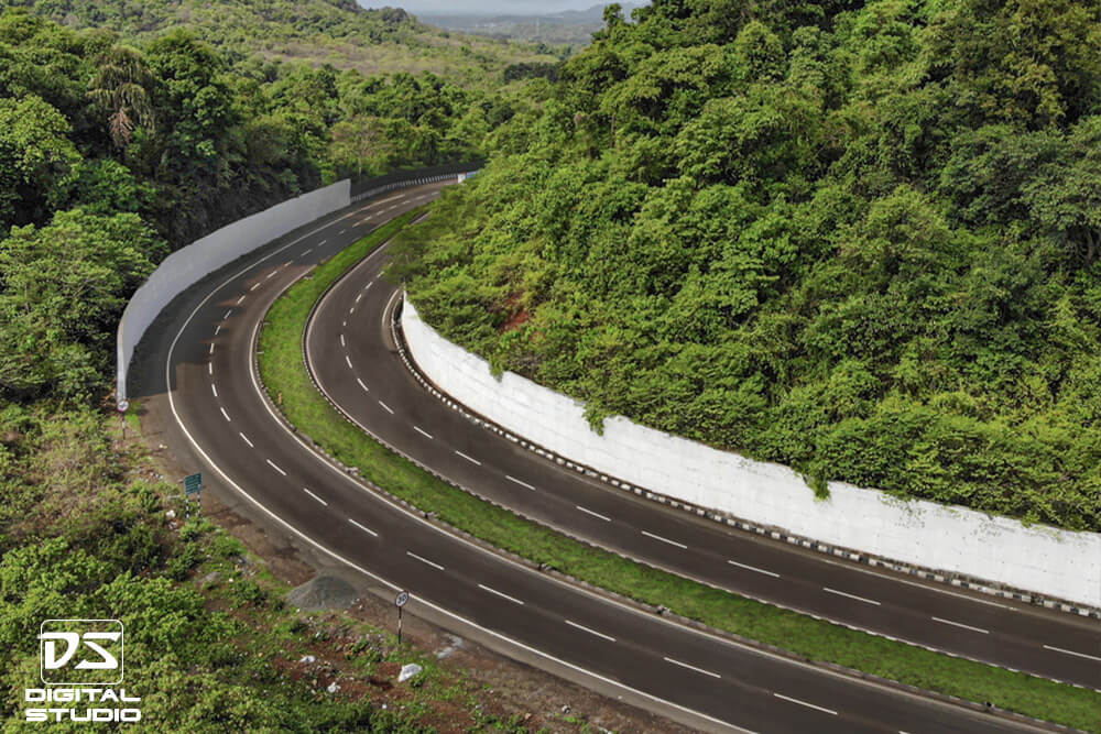
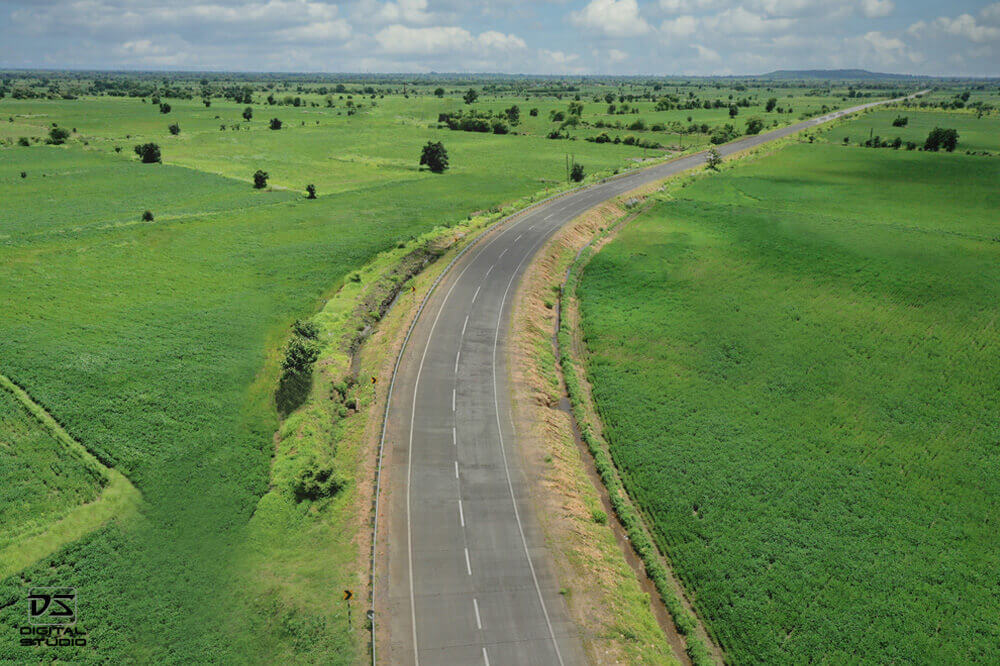
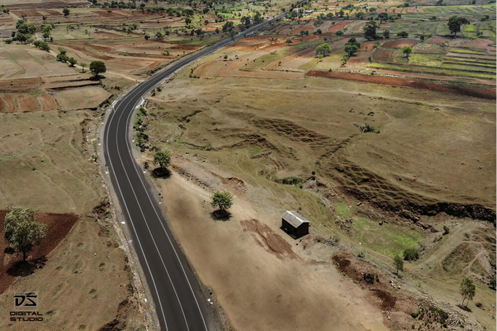
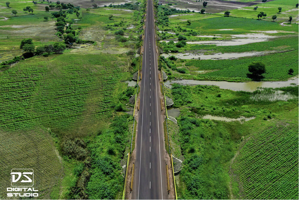
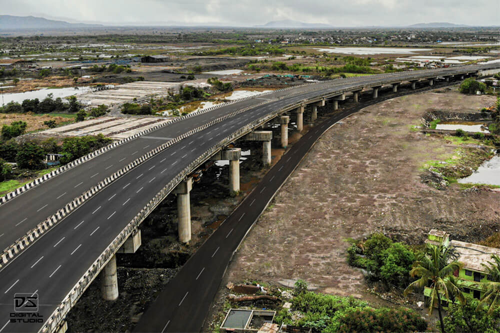
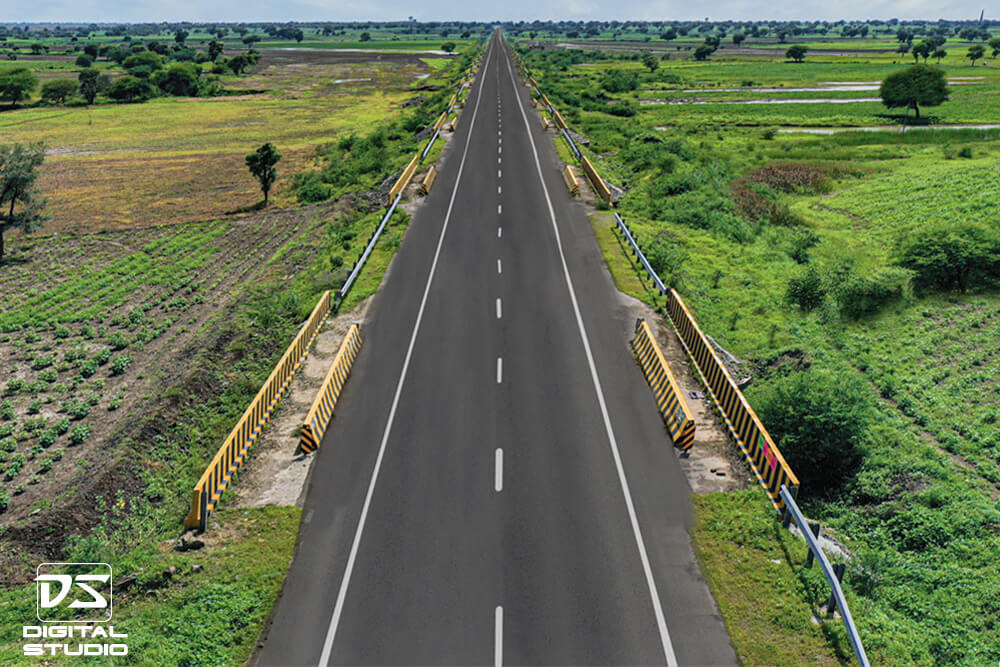
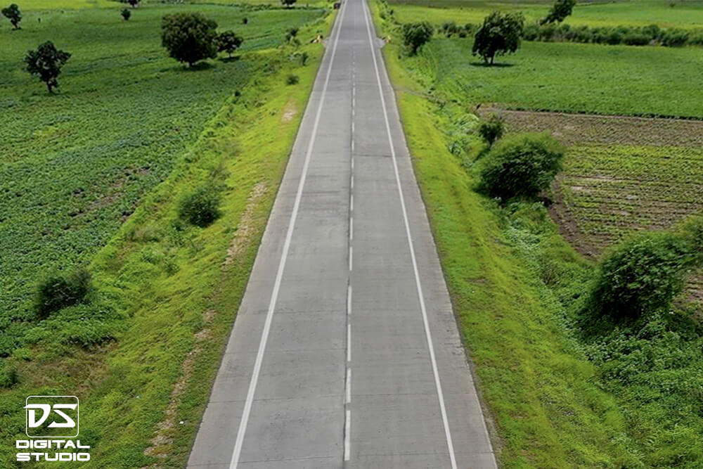
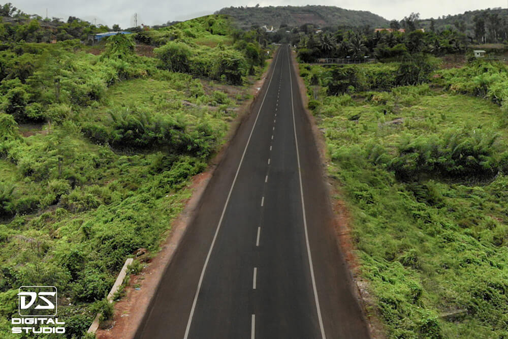
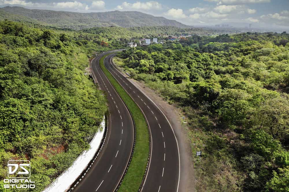
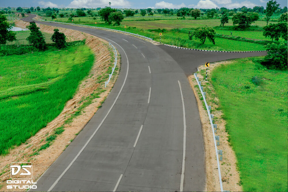
These images show corridor-scale documentation used to record highway alignment, terrain context, interchange geometry, and overall infrastructure visibility across completed road projects.

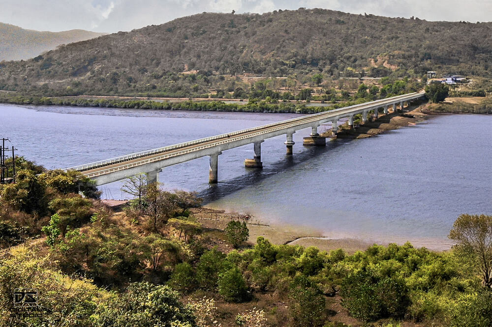
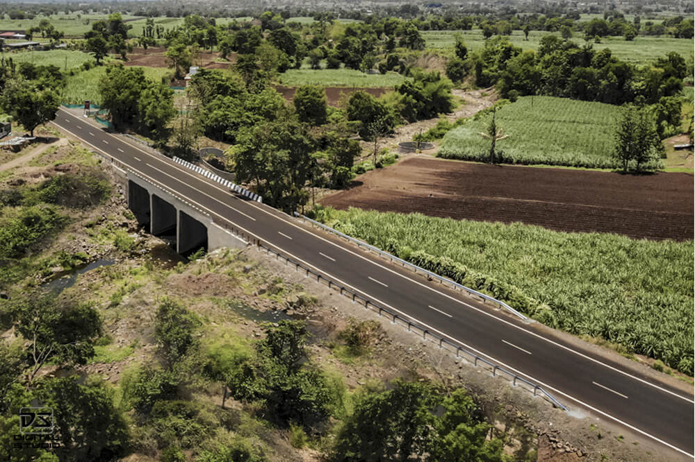
These photographs document bridges, culverts, approach roads, and major engineering structures that form part of highway and transportation infrastructure projects.
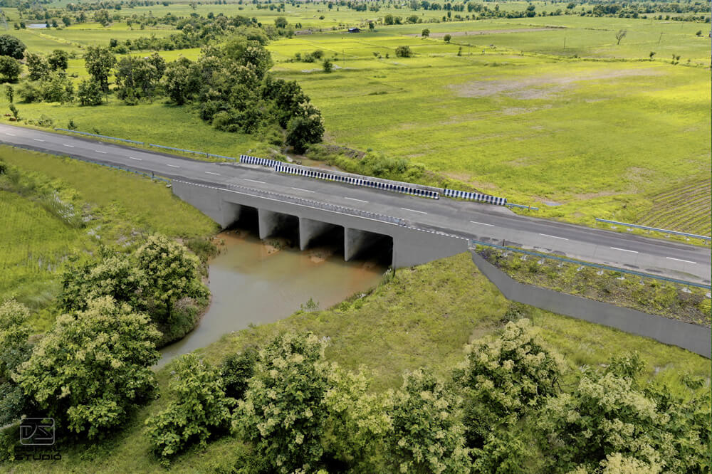
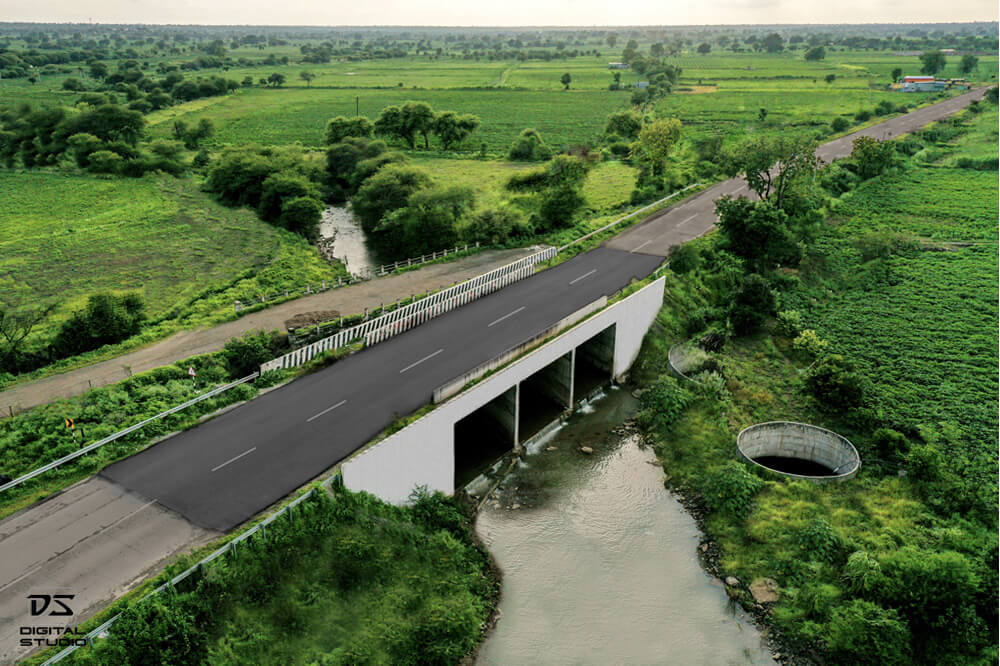
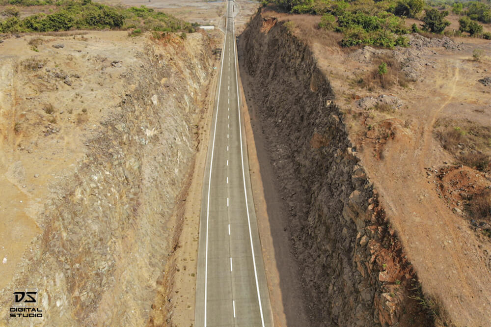
These images show carriageway sections, road curves, embankments, bridge crossings, and alignment details that are relevant for infrastructure documentation and reporting.

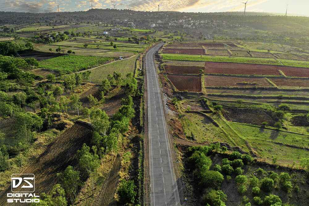
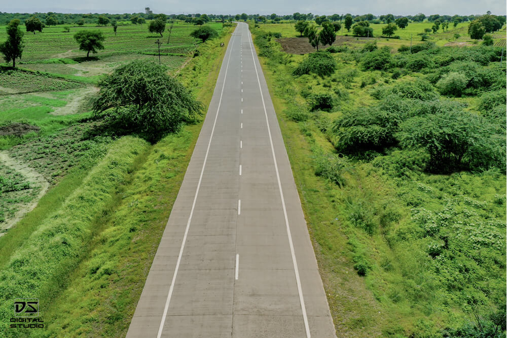
These examples show repeatable documentation coverage across different project stretches, agricultural zones, rural corridors, and varied highway alignments.
Digital Studio is a pan-India visual documentation company serving industrial, engineering, and infrastructure-led assignments. We understand that infrastructure projects are not lifestyle shoots or generic commercial shoots. They require planning, location sense, disciplined execution, and outputs that are useful for reporting and records.
The following project photographs show how drone imaging can be used to document completed highways, bridges, corridor alignment, terrain context, and road infrastructure at scale. This style of documentation is useful for project reporting, completion records, investor communication, and infrastructure portfolio development.
Contact Digital Studio to discuss corridor length, project stage, bridge count, locations, and the type of documentation your team requires.
Call / WhatsApp: +91 98205 78189
Email: contact@digitalstudio.in
Highway and infrastructure documentation is the professional visual recording of roads, bridges, corridors, junctions, and related civil works using drone and ground photography. It is used for project reporting, completion records, engineering communication, and structured visual archives.
These services are useful for highway EPC contractors, road developers, bridge contractors, consultants, infrastructure operators, project management teams, investors, and government departments that need reliable visual records of project execution or completed assets.
No. Infrastructure documentation can be done at multiple stages including pre-construction, during execution, at milestone stages, and after completion. Many companies use it as a recurring progress documentation service.
Yes. The workflow can be planned for linear infrastructure projects across long stretches, including multiple bridges, junctions, culverts, and access roads, depending on the scope and schedule.
Both options are possible. Drone coverage is useful for alignment, scale, bridges, and terrain context, while ground photography adds detail-level visuals and structure-specific views.
Typical deliverables include high-resolution aerial photographs, ground-level project photographs, bridge documentation images, structured folders by location or milestone, and selected aerial video clips if required.
Yes. The photographs are suitable for internal reporting, management presentations, investor updates, project completion submissions, websites, brochures, and tender support material.
Yes. Digital Studio provides pan-India documentation services for infrastructure, industrial, and engineering-led projects.
Yes. Many highway and road projects run through remote, semi-rural, or difficult-access regions. The documentation workflow can be planned accordingly based on terrain, travel, and permissions.
Yes. Recurring documentation is one of the most useful applications of this service. Periodic imaging creates a structured visual timeline of project progress and helps management track execution more clearly.
This is a documentation-focused service, not generic drone photography. The emphasis is on project visibility, reporting value, location relevance, structured coverage, and commercially useful deliverables for engineering and infrastructure stakeholders.
You can contact Digital Studio with the project location, approximate corridor length, number of bridges or structures, current project stage, expected outputs, and timeline. Based on this, a suitable scope and quotation can be prepared.
Highway and infrastructure projects need more than occasional site photographs. They need clear, organised, and professionally captured visual records that can support reporting, reviews, internal communication, and long-term archives. Digital Studio provides pan-India documentation services for roads, bridges, and engineering-led infrastructure assignments with a practical focus on clarity, coverage, and usable deliverables.
Last updated: