Linear Infrastructure Documentation & K2K Corridor Mapping
Our expert team provides precision linear infrastructure documentation and K2K corridor mapping services for large-scale engineering and transport projects across India.
What is Linear Infrastructure Documentation?
Linear infrastructure documentation is the systematic visual recording of long-range assets that span hundreds of kilometers. Unlike standalone site photography, linear documentation requires K2K (Kilometer-to-Kilometer) tracking, GPS-aligned drone imaging, and structured data management to provide a continuous visual audit trail of the entire corridor alignment, right-of-way (ROW), and structure inventory.
Specialized Capabilities for Mega-Corridors »
Managing the documentation of a 200km highway or a multi-state pipeline requires a different logistical approach than a single factory shoot. Our workflow is built for scale:
Chainage-Based Reporting: Visuals organized by Project Chainage (e.g., KM 00+000 to KM 150+000) for engineering ease.
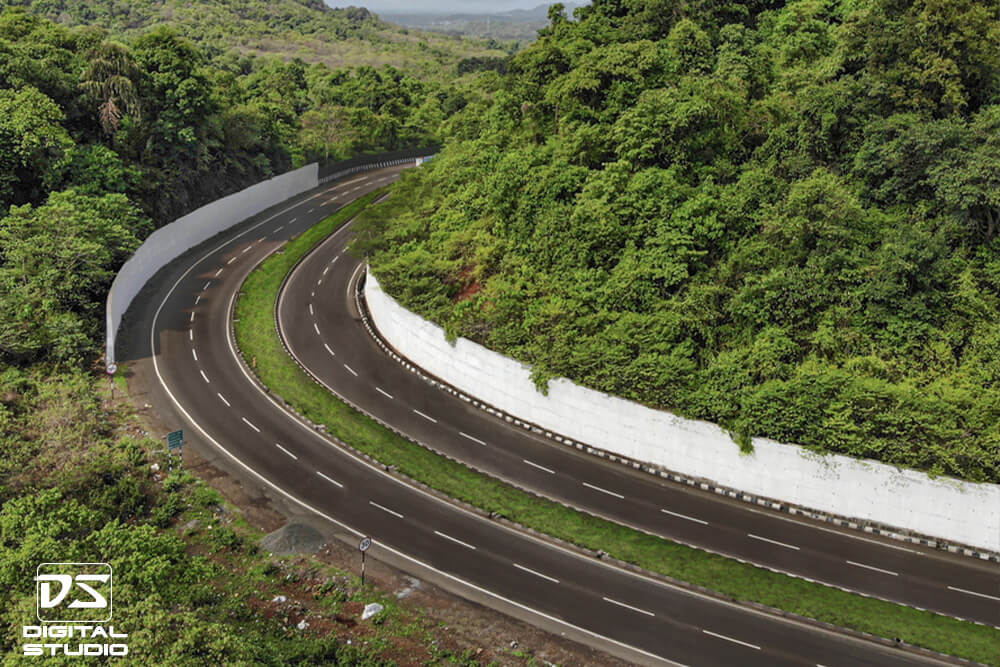
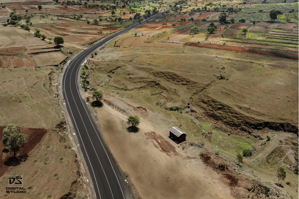
Corridor Continuity: Consistent drone altitude and camera angles to ensure a seamless view of the project alignment.
Remote Logistics: Rapid deployment teams capable of moving with the "construction front" in rural or difficult terrains.
Visual Audit Trails: Verifiable records of ROU (Right of Use) clearing and embankment progress.
Stakeholder Transparency: High-resolution media for NHAI, Ministry, and Investor review meetings.
Structure Inventory: Systematic recording of all ROBs, RUBs, Culverts, and Minor Bridges within the linear stretch.
Linear Asset Projects Covered »
National Expressways: Full Right-of-Way (ROW) and interchange geometry documentation at scale.
Railway & Metro Corridors: Capturing track alignment, OHE installations, and corridor connectivity.
The Technical Advantage of K2K Mapping »
Professional linear documentation solves the "Data Gap" in massive engineering projects. By providing high-resolution ground and aerial views tagged to specific locations, we help EPC contractors and Developers with:
Encroachment Monitoring: Identifying unauthorized structures or land-use changes along the corridor.
Topographical Context: Visualizing how the linear asset interacts with water bodies, hills, and local villages.
Sub-grade to Finished Pavement: Documenting layers of construction (PQC/DBM) across the entire stretch.
Discuss Your Corridor Documentation Project »
Planning documentation for a highway, pipeline, or rail corridor? Let's discuss your project scale and reporting needs.