Mapping, measurements, and site intelligence using DGCA-compliant UAV operations.
Introduction »
Digital Studio (estd. 2008) provides pan-India drone survey services for construction, infrastructure, industrial sites, real estate, and renewable energy projects. We capture aerial data for mapping, monitoring, measurements, and documentation—delivered in formats your engineering, project, and stakeholder teams can actually use.
Let's Discuss Your Project
Looking for professional services? Connect with our team to discuss your project requirements.
A drone survey is the structured capture of aerial photographs and videos (and where required, mapped image sets) to produce measurable outputs such as orthomosaic maps, 3D site models, volumetric measurements, and progress documentation. The purpose is simple: replace slow, high-risk, or incomplete site documentation with repeatable aerial intelligence.
Who Needs Drone Survey Services? »
Drone surveys are used by teams that manage land, construction, assets, or large sites where ground-level visibility is limited.
Construction & Infrastructure Projects: For progress tracking, stakeholder reporting, and documentation across project phases.
Industrial Plants & Warehousing: For large-facility visuals, layout documentation, safety communication, and asset records.
Real Estate Developers & Project Consultants: For site context, marketing documentation, and periodic progress updates.
Mining, Earthworks & Material Stockyards: For volumetric estimation and measurement-ready site intelligence (where required).
Renewable Energy Teams: For site documentation and inspection-support visuals (wind/solar infrastructure).
Ports, Logistics & Large Campuses: For overview mapping, access planning, and infrastructure documentation.
What Is Drone Survey Used For? »
Progress monitoring: Repeatable aerial documentation for weekly/monthly progress reviews.
Site mapping & planning: Orthomosaic maps and site visuals that improve planning and coordination.
Measurements: Area/volume calculations for stockpiles, earthworks, and material tracking (scope-dependent).
Inspection-support visuals: High-detail imagery for assets, roofs, structures, and hard-to-access areas.
Stakeholder communication: Cleaner reporting for management, lenders, investors, and clients.
Archive & compliance records: Visual evidence of site conditions over time.
Drone surveys are increasingly being used for infrastructure monitoring, especially in road and highway development where periodic aerial inspections help project teams evaluate alignment progress, structure completion, and site logistics. For projects that require structured visual documentation beyond survey mapping, explore our highway infrastructure documentation services designed for engineering teams and infrastructure developers working on large corridor projects.
Capabilities & Specialisations »
We plan flights based on site conditions, outputs required, and usage context (engineering planning, management reporting, marketing, inspections, or documentation).
DJI Mavic 4 Pro (Enterprise-grade capture): 100MP stills and 6K video for high-detail site documentation and inspection-ready visuals.
Consistent coverage: Repeatable flight paths for time-series monitoring and comparative reporting.
Deliverables-first planning: We plan capture based on what you need to deliver internally (reports, measurements, approvals, presentations).
Survey Outputs (As Required) »
Orthomosaic maps (project scope dependent)
3D site / terrain models (project scope dependent)
Volumetric measurements for stockpiles/earthworks (when required)
High-resolution photo sets for documentation and inspection-support
4K/6K aerial videos for reporting and stakeholder communication
We can also integrate aerial capture into industrial video production↗ workflows when the goal is communication, training, or brand documentation (not just mapping).
Latest Project - Lanovala; Maharashtra »
Advanced Drone Fleet for Nationwide Surveying »
Digital Studio offers pan-India deployment of specialized UAVs for professional aerial surveying and mapping. Our nationwide service network is equipped to handle complex data acquisition for industrial and infrastructure projects in all major Indian hubs.
Matrice 4T (RTK Precision) ↗ Flagship enterprise drone for industrial mapping, thermal inspections, and sub-centimeter survey accuracy across India.
Mavic 4 Pro (Advanced Mapping) ↗ Ideal for high-resolution site photography and rapid terrain assessment in diverse environments.
Inspire 3 (8K Data Capture) ↗ Provides ultra-high-definition 8K data for cinematic site documentation and infrastructure monitoring.
Mavic 3 Classic/Cine ↗ Professional-grade imaging with ProRes capabilities for high-fidelity post-survey visualization.
Inspire 2 (Modular Surveying) ↗ Proven aerial platform for environmental surveys and architectural documentation projects.
Digital Studio provides nationwide services, ensuring professional drone data capture is available for projects in Mumbai, Navi Mumbai, Thane, Pune, Surat, Delhi NCR, Bengaluru, Hyderabad, Chennai, Ahmedabad, and Pan-India.
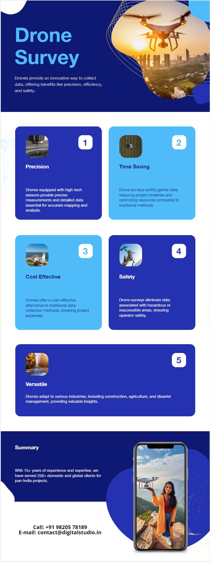
Drone surveying services have become increasingly popular, providing unparalleled precision, efficiency, and cost-effectiveness.
In this article, we will delve into the various aspects of aerial surveying provided by us pan-India, exploring how we offer drone services for industries such as construction, agriculture, infrastructure inspection, and many more like inspection of solar arrays↗ and wind turbine blades↗.
Strategic Advantages of Digital Studio’s Nationwide Drone Surveys »
Digital Studio provides industry-leading drone surveying and mapping solutions across India. By integrating advanced UAV technology with professional geospatial analysis, we offer a comprehensive suite of benefits for national infrastructure and industrial projects.
Precision and Engineering-Grade Accuracy:
Utilizing high-resolution sensors to capture sub-centimeter data, providing precise measurements and high-density 3D point clouds for complex engineering requirements.
Unmatched Time-Efficiency & Rapid Deployment:
Our Pan-India presence allows for quick mobilization. Large-scale geographic sites that once required weeks of manual labor are now mapped in a fraction of the time from high-altitude perspectives.
Cost-Effective Data Acquisition:
Digital Studio minimizes the need for extensive manpower and heavy machinery, offering a scalable, budget-friendly solution for nationwide land surveys and industrial audits.
Safety in Hazardous Operational Zones:
Drones access hard-to-reach or dangerous environments—including disaster-hit sites, flood zones, and structurally compromised factories—keeping personnel safe while capturing critical visual evidence.
Cross-Industry Versatility:
Our services are tailored for diverse sectors including construction, renewable energy, and urban planning, ensuring a consistent standard of professional aerial intelligence from Mumbai to Delhi.
Digital Studio: Delivering professional drone survey services and actionable aerial insights across every state in India.
Construction Site Surveying »
In the construction industry, time and accuracy are critical. Drone surveying companies like us, provide construction site surveying services that enhance project planning, monitoring, and management.
Here's how:
Site Analysis and Planning: Drones can quickly capture detailed images of the construction site, enabling accurate site analysis and planning. This includes assessing topography, identifying potential obstacles, and planning site logistics.
Progress Monitoring: Regular aerial surveys allow project managers to monitor construction progress in real time. By comparing current data with previous surveys, any deviations from the plan can be identified and addressed promptly.
Volume Calculations: Drones can accurately measure stockpiles, excavation volumes, and earthwork quantities, aiding in precise material management and cost estimation.
Safety Inspections: Construction sites often pose safety hazards. Drones can conduct aerial inspections to identify potential safety issues, ensuring compliance with safety regulations and reducing the risk of accidents.
Agricultural Surveying »
Agriculture is another sector where UAV surveying services make a significant impact.
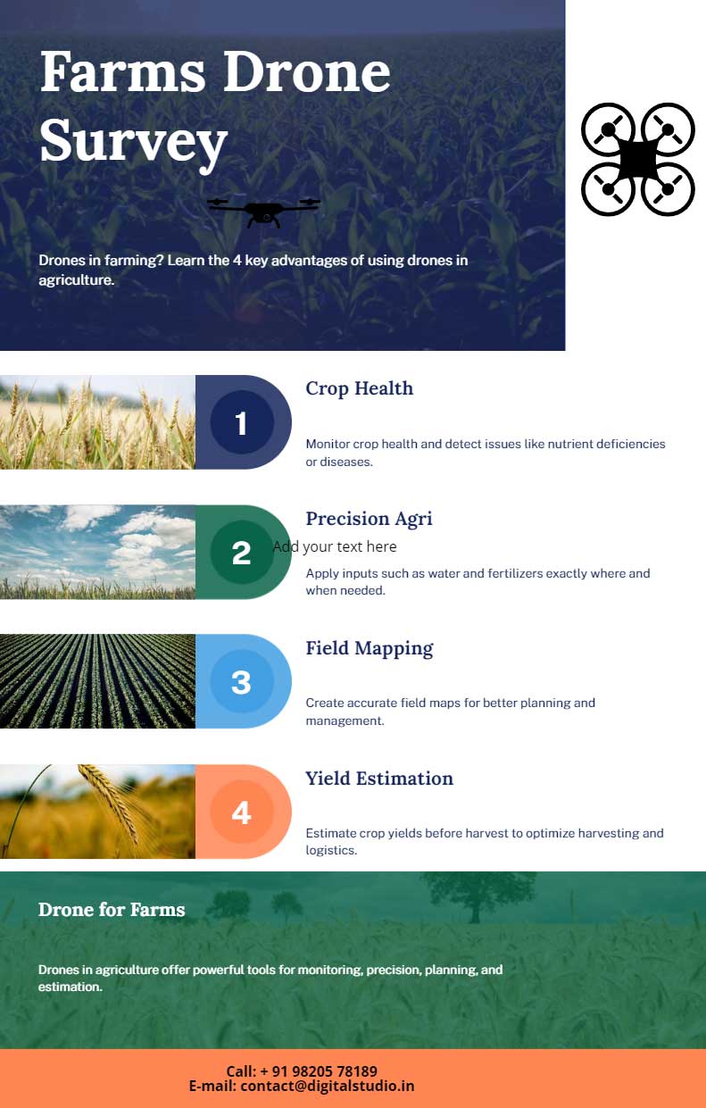
Our agricultural drone surveying provides farmers with valuable insights to optimize crop management and improve yields.
Here are some advantages:
Crop Health Monitoring: Drones equipped with multispectral sensors can capture detailed images that reveal the health of crops. This allows farmers to detect issues such as pest infestations, nutrient deficiencies, and water stress early, enabling timely interventions.
Precision Agriculture: By analyzing data collected from drones, farmers can implement precision agriculture techniques. This includes variable rate application of fertilizers, pesticides, and water, reducing waste, and maximizing efficiency.
Field Mapping and Planning: Drones can create detailed maps of agricultural fields, aiding in field planning, irrigation design, and crop rotation strategies. This ensures optimal use of resources and enhances overall productivity.
Yield Estimation: Accurate yield estimation is crucial for effective planning and marketing. Drones can provide precise data on crop density and growth stages, helping farmers predict yields with greater accuracy.
Infrastructure Inspections with UAVs »
Infrastructure inspections are vital for maintaining the safety and integrity of critical structures such as bridges, power lines, and pipelines. Traditional inspection methods can be time-consuming, costly, and hazardous.
However, aerial infrastructure inspections offer a safer and more efficient alternative.
Bridges: Drones can capture high-resolution images and videos of bridge structures, identifying cracks, corrosion, and other structural issues. This enables timely maintenance and reduces the risk of accidents.
Power Lines: Inspecting power lines manually is dangerous and labor-intensive. Drones equipped with thermal cameras can detect hot spots and faulty connections, ensuring reliable power supply and minimizing downtime.
Pipelines: Monitoring pipelines for leaks and damages is crucial to prevent environmental disasters. Drones can conduct aerial inspections along pipeline routes, identifying potential issues and facilitating timely repairs.
Buildings: High-rise buildings and skyscrapers require regular inspections to ensure structural integrity. Drones can access hard-to-reach areas, providing detailed visual data for comprehensive building inspections.
Why Partner with Digital Studio: 4 Strategic Reasons »
When selecting a drone partner for national projects, the following factors define our industry-leading position:
Unmatched Experience & Expertise:
We bring over 15 years of specialized experience in pan-India industrial production. Our portfolio spans high-end corporate videos, 360-degree interactive tours, and professional industrial photography for the country's leading brands.
Comprehensive Nationwide Service Range:
Beyond localized shoots, we provide turn-key aerial solutions. This includes
pan-India drone photography,
high-resolution 4K UAV shoots, and
advanced 6K drone videography.
We also specialize in 360° aerial captures for immersive site monitoring.
Full Regulatory & DGCA Compliance:
Drone operations in India are strictly governed by the DGCA. Digital Studio ensures all projects are 100% compliant, possessing all necessary licenses, insurance, and flight permits to operate legally in various zones across India.
Industry-Leading Drone Technology:
We deploy a fleet of best-in-class, specialized drones. By matching the specific hardware to your project’s unique requirements—whether it's thermal mapping or 8K cinema—we ensure the most optimum visual and technical results.
A drone survey uses aerial imagery captured by drones to create maps, 3D models, and measurement outputs for planning, monitoring, and documentation.
Which industries benefit from drone surveying?
Drone surveys are commonly used in construction, infrastructure, real estate, mining, energy, and industrial projects for mapping, progress monitoring, and visual inspection.
How accurate are drone survey results?
Accuracy depends on flight planning, ground control, and the processing workflow. For engineering-grade work, surveys may include ground control points and calibrated processing.
Do you provide post-processing and 3D modeling?
Yes. We can deliver processed outputs such as orthomosaics, 3D models, volumetric measurements, and report-ready visuals in commonly used formats.
Where are your drone survey services available?
We execute drone survey projects across India, including Mumbai, Navi Mumbai, Thane, Pune, Surat, Delhi-NCR, Bengaluru, Hyderabad, Chennai, Ahmedabad, and multi-site coverage.
Conclusion »
Drone surveys reduce blind spots on large sites. Instead of relying on partial ground documentation, you get consistent aerial coverage that supports planning, monitoring, measurements, and reporting across project stages.
Last updated:
Let's Discuss Your Project
Looking for professional services? Connect with our team to discuss your project requirements.